SOCET GXP 3.2

Tool that uses imagery satellite to identify and analyze ground features
Rating
Your vote:
Latest version:
4.1 See all
Developer:
BAE SYSTEMS Geospatial eXploitation Products
Screenshots
1 / 3
Request
Download
link when available

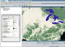
SOCET GXP is a geospatial-intelligence (GEOINT) tool that uses imagery from commercial, satellite, and tactical means to identify and analyze ground features. Using SOCET GXP, you can automatically measure and store properties such as scale, elevation, latitude, and longitude in a series of images to expedite geospatial production, image analysis, and map creation. The data then can be used to perform before-and-after site comparisons, coordinate operational missions, assess navigation safety, and monitor changes over time.

Comments

User

Your vote:

Related software

MapInfo Professional
rating

Create maps from different kinds of data using this program.

TerraExplorer
TerraExplorer
rating

3D GIS desktop viewer and creator.

MakerWare
MakerWare
Free
rating

It enables you to drive your MakerBot Replicator Desktop 3D Printer.

MAPS
MAPS
Free
rating

Compares the Microchip's ADC-SAR parameters to other ADC-SAR parameters.

Atlas DMT
Atlas DMT
rating

Graphic interactive system for 3D surface modeling